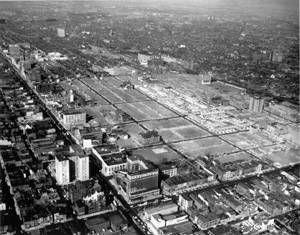
Created during the 1960s era of urban renewal, Yorktown is located 10 blocks north of City Hall, below the southern edge of Temple University's main campus. The developer chose the Battle of Yorktown as his geographic "image," and gave the streets Revolutionary-era names—whether Philadelphia related or not—such as Saratoga Place, Betsy Ross Place, King's Place, Patrick Henry Place, and Valley Forge Place.
Not an organized community before the 1960s, the nine-block area was an anonymous part of North Philadelphia. First developed during Philadelphia's industrial-expansion period, the predominant 19th- and 20th-century land use was row housing for workers in factories along Broad Street or beside the nearby Reading Company railroad tracks. Smaller industries included the Philadelphia Home Made Bread Company, which once occupied a portion of the east side of 12th Street, south of Jefferson Street.
During the 20th century much of the area's housing stock deteriorated, and many structures were subdivided into overcrowded apartments with inadequate plumbing and substandard electrical service. In 1950, a City-commissioned study identified this neighborhood as one of the most distressed sections of North Philadelphia, making it a prime candidate for urban renewal.
Unlike many other
urban neighborhoods that experienced economic disinvestment during the
late 20th century, this area's proximity to Temple University and to Center
City provided excellent access to education, jobs, shopping, and entertainment.
The geographic value was recognized in a 1963 marketing study by the Jackson-Cross
Company, which described the area as "one of the most accessible
sites in the city of Philadelphia." ![]()
![]()
